I started my tour early today, at 7:30am. My taxi driver, Mr. Lai, drove us north from Siem Reap and stopped at the ticket office so I could by my ticket. You can buy one day ($20), three day ($40), and seven day tickets ($60) for Angkor Wat park (I got the 3 day ticket). Despite the crowd of folks at the ticket office, I was in and out of there within a few minutes.
The tour I’m doing builds up to Angkor Wat on the last day, so today being my first day, I saw a number of smaller temples. To get to the first temple, Mr. Lai drove us around the periphery of Angkor Wat and through the South Gate and North Gates of Angkor Thom (another huge temple complex here). We stopped to take a few photos at the Gates. We’ll be coming back tomorrow, but I couldn’t resist snapping a few shots now.

North Gate of Angkor Thom
The first temple I visited was Preah Khan. Mr Lai dropped me off at the East Gate of Preah Khan and I walked through the temple and met him at the West Gate where we continued onwards. Preah Khan was built in the 12th century under the reign of King Jayavarman VII and is located to the northeast of Angkor Thom and just west of the Jayatataka baray, with which it was associated (a “baray” I learned is an artificial body of water, and a common element in Khmer architecture). One of King Jayavarman’s largest temples, Preah Khan is thought to have been a city as well as a Buddhist university. The site is largely unrestored so there are many trees growing among the ruins. It was the largest group of ruins I visited today.
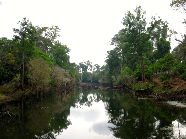
Moat around Preah Khan

Preah Khan East Gate

Carved designs on the stone
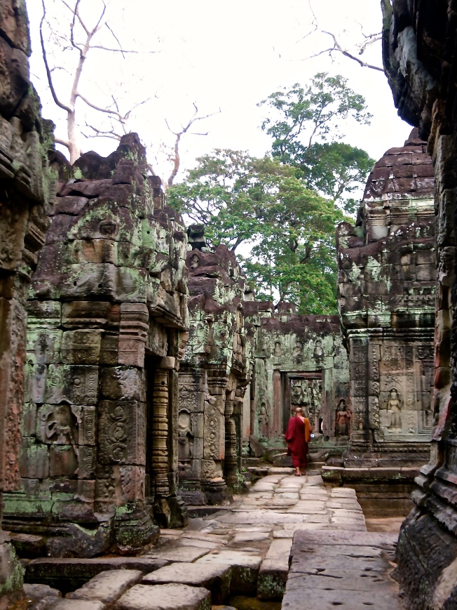
Around the Preah Khan Ruins. There was a monk visiting the ruins.

Ruins at Preah Khan

Trees and vegetation growing around the ruins
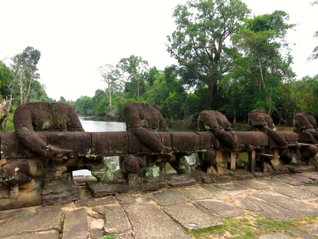
Crossing the moat outside the West Gate
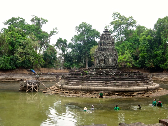
Next we went to Neak Pean to the east of Preah Khan. Neak Pean is an artificial island with a Buddhist temple. Similar to Preah Khan, Neak Pean was built during the reign of King Jayavarman VII, in the late 12th century. The temple was originally designed for medicinal purposes and might have acted as a type of hospital. It is thought that the pools and waters at Neak Pean may represent Anavatapta, a mythical lake in the Himalayas where the waters are thought to cure illness.
This was a small series of ruins. To get to the artificial island you cross over this swamp/marsh on a wooden bridge. At the island, in the center of the pools you see the temple.

Wooden bridge/plank to get to Neak Pean

Neak Pean temple
Horse statue on the left coming out of the water
In this last photo you’ll notice there are some people in the water. They work for the Angkor Wat park and were clearing out foliage and vegetation from the water.
Next we visited Ta Som, which is east of Neak Pean. Ta Som is a small temple that feels quite remote. It’s also overgrown with trees and vegetation, and features a few face-towers. It’s a very charming miniature temple, built in the late 12th century under the reign of Jayavarman VII, and then was later enlarged by Indravarman II in the 13th century.

Face Towers at Ta Som. I’ll see more of these tomorrow

Ta Som ruins

Overgrown tree on the ruins with face tower
After visiting Ta Som, we made our way south east to East Mebon, in the East Baray. East Mebon was built in the middle of the 10th century under the reign of Rajendravarman. East Mebon is located within the massive East Baray, which was built about half a century before the temple as the water source for the city here.

Main Temple at East Mebon

Guardian Elephant at East Mebon on the south east corner
East Mebon
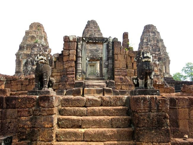
We continued a little further south of the East Baray to Pre Rup. This temple was also built in the middle of the 10th century during the reign of Rajendravarman. This temple looks a lot like East Mebon, but apparently Pre Rup is a “temple-mountain” (the structure is meant to look symbolically like a mountain) whereas East Mebon is not. You can tell the difference when hiking up to the top. Pre Rup is crazy steep and has a lot of steps to go up, whereas East Mebon has a series of terraces but really isn’t that high up.

Pre Rup

View from the top of Pre Rup
After Pre Rup, we went quite a ways south east to see a group of temples called the Roluos Group, which consists of three sites: Bakong, Preah Ko, and Lolei. These temples were the oldest that we visited today, dating from the 9th century. We first visited Bakong, the first significant temple-mountain built in the area. It was constructed in the late 9th century during the reign of Indravarman I.

Bakong pyramid
One of my favorite aspects of the temples I saw today were all the gorgeous high relief carvings and sculptures like these.

High relief carvings at Bakong
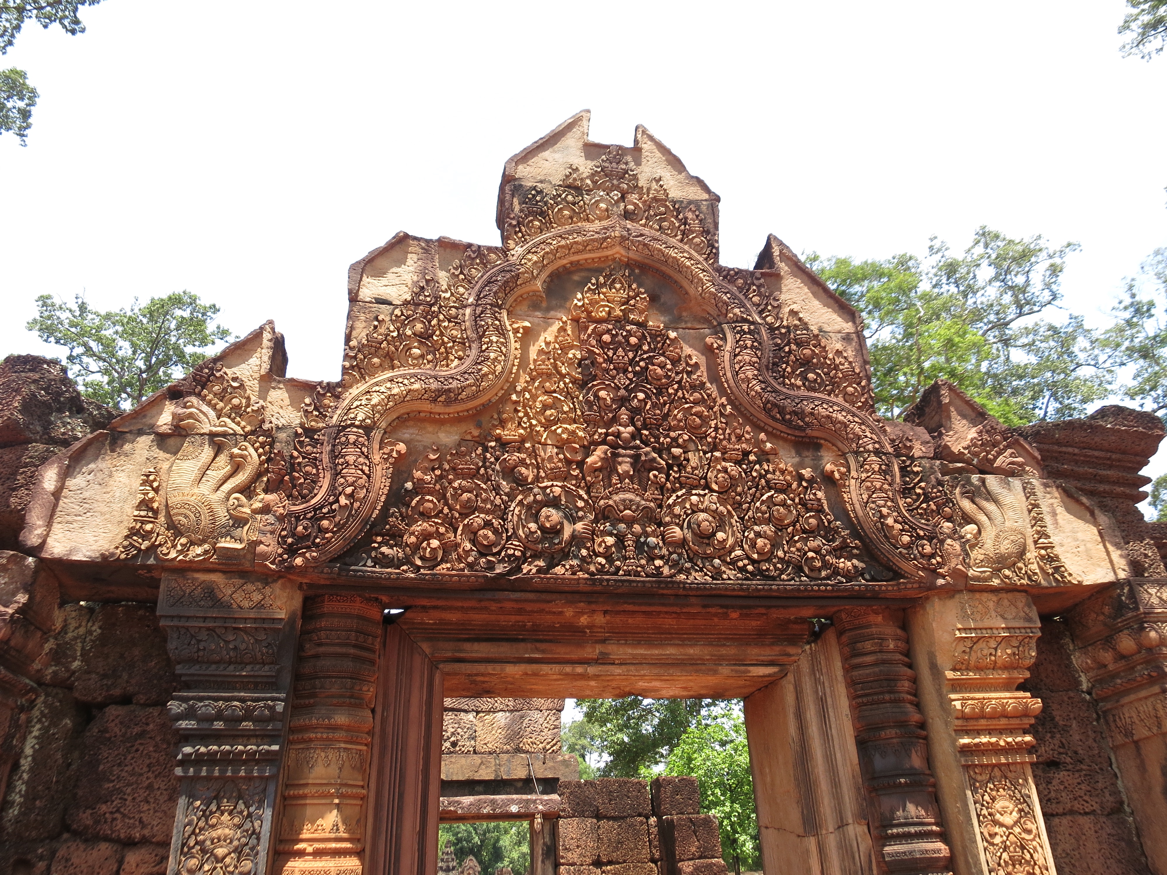
Next we stopped a short ways away at Preah Ko, a 9th century temple with 6 towers featuring some very beautiful carvings on the doorway lintels.

Preah Ko
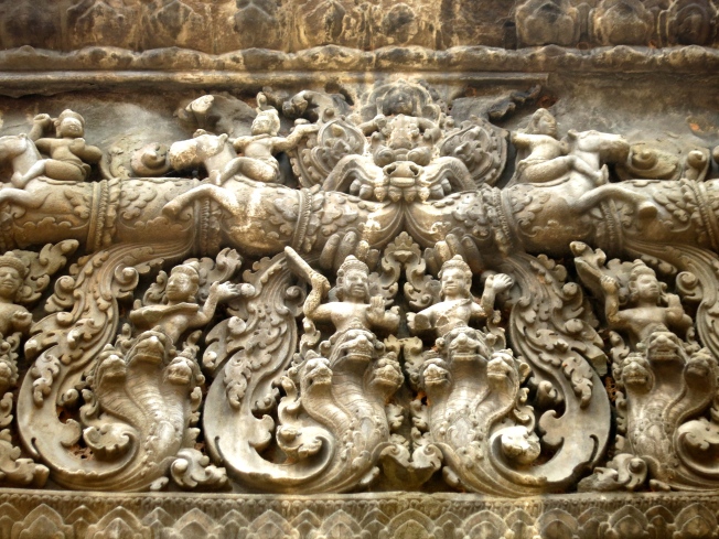
Detail of lintel carving at Preah Ko

Another detail of lintel carving at Preah Ko

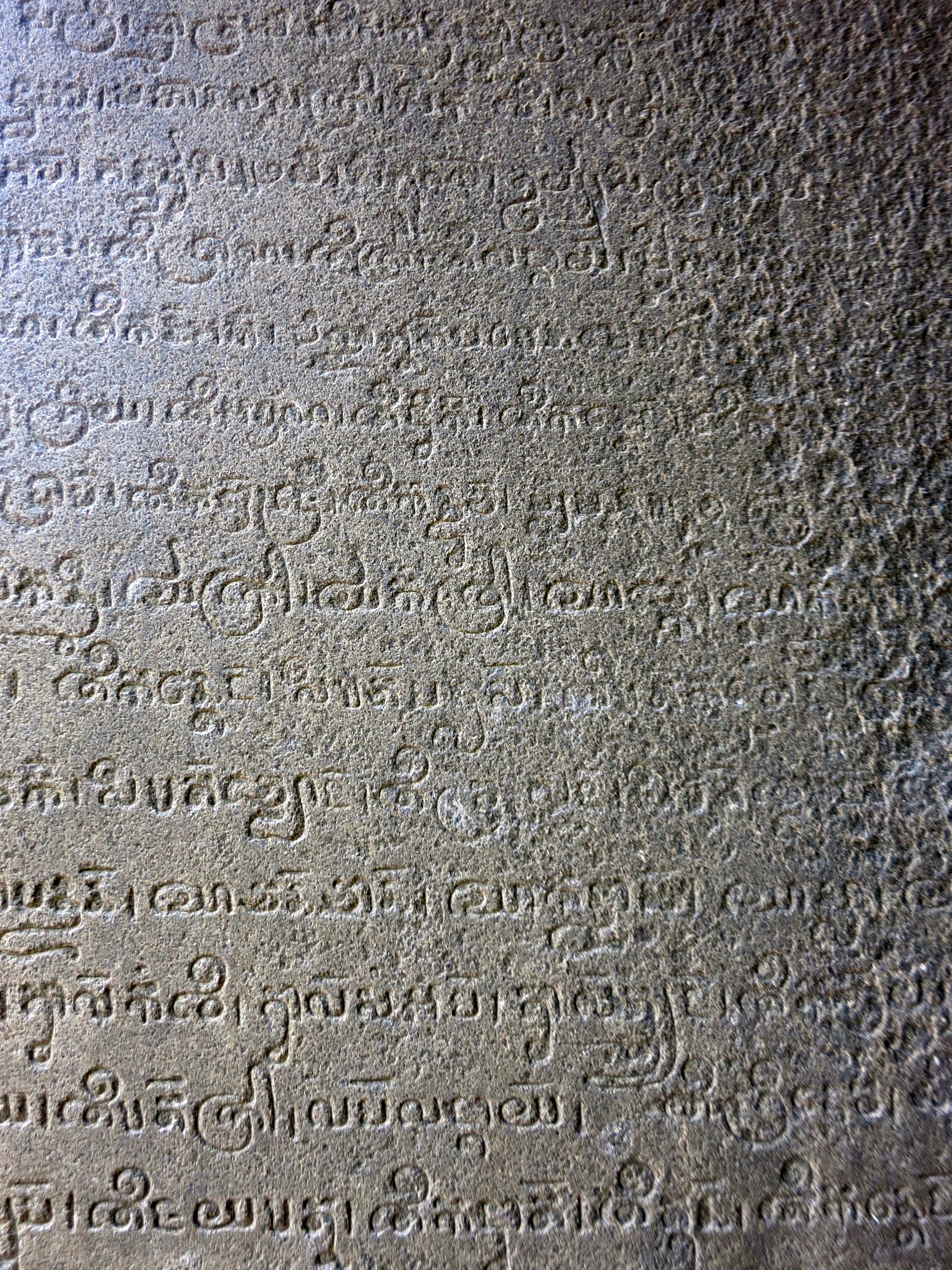
Carved writing on a wall at Preah Ko
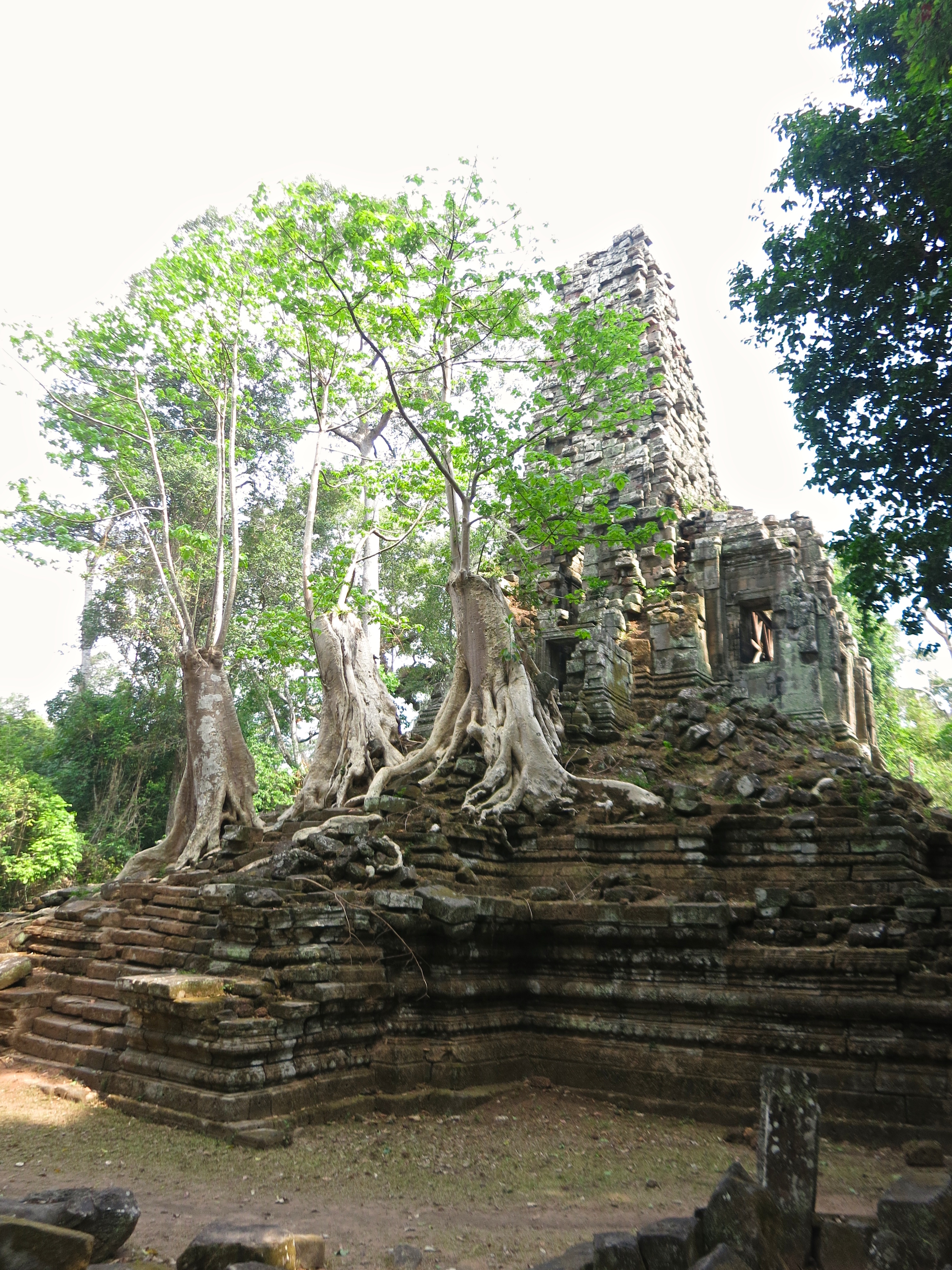
The last temple of the Roluos group is Lolei, a tiny 9th century temple formerly on an island and now undergoing some heavy restoration.
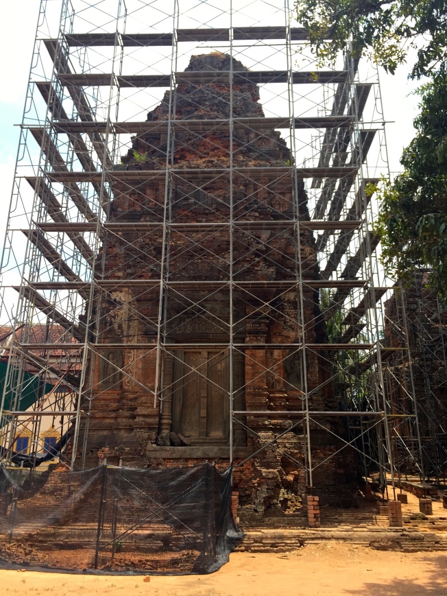
Lolei
It was 1pm by the time we finished visiting all these sites–almost 6 hours of touring. It was pretty exhausting, but luckily it was lunch time. Mr. Lai dropped me off at Pub Street in town and I had a little lunch in the area. After a bit of post-lunch shopping and wandering through the boutiques and galleries near Pub Street, I made my way back to the hotel to relax for an hour before Mr. Lai picked me up to go to a smaller temple called Phnom Bakheng to see the sunset. We headed up at 4:30pm since this temple in particular gets pretty filled up with tourists for the sunset.
Phnom Bakheng is a 9th century temple on top of a hill about 1.5 kilometers away from Angkor Wat. The reason for its popularity among tourists is that it provides a nice vantage point for the sunset over the West Baray, as well as a view of Angkor Wat.

View of Angkor Wat through the trees from Phnom Bakheng

A little closer view of Angkor Wat from Phnom Bakheng

Carvings on a doorway on Phnom Bakheng main temple

Sunset over the West Baray
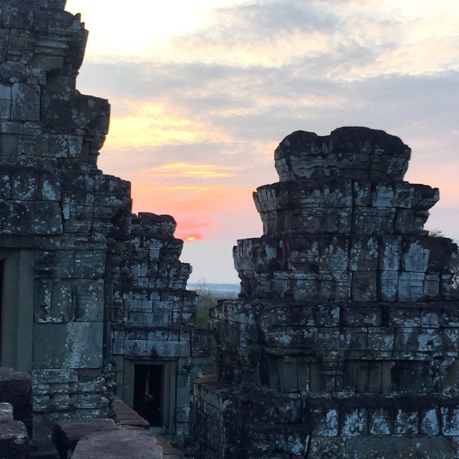
Sunset through the towers of Phnom Bakheng
Once night fell, Mr. Lai picked me up and I went to dinner at a lovely local restaurant called Viroth.
Tomorrow I continue my touring early, once again, so off to bed for me!